


onX Backcountry Trail Maps GPS
4.3955.00 Reviews
App Specs
- Version
- 26.32.1
- Updated On
- License
- Free
- Downloads
- 500,000+
- Developer
- onXmaps
- Categories
- Sports
- Platform
- Android, iOS
Screenshots
 Analysis by AppCompare
When it comes to exploring the great outdoors, having the right tools at your disposal can make all the difference. Enter onX Backcountry Trail Maps GPS, an app that's been making waves among hiking enthusiasts and outdoor adventurers alike. Let me take you through my experience with it and why it might just become your new trail buddy.
Why the map matters beyond the trail line
The most useful way I think about this app is as a planning map that can also stay useful once a trip begins. A trail line tells me where a route goes; a backcountry map is more valuable when it helps me judge the shape of the surrounding terrain and orient myself when the route is no longer obvious. That distinction matters on a hike, ride, or ski tour where the marked path is only part of the decision.
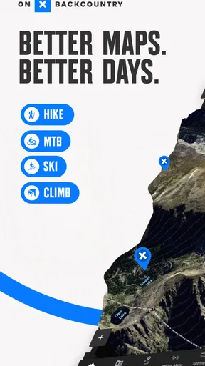
onX Backcountry is a free sports app from onXmaps, and its central appeal is the combination of GPS navigation, 3D maps, and outdoor guide material. It has a 4.3 average from around 2,300 ratings, with more than 500,000 installs, so it is used by a substantial group of outdoor travelers without being a universal replacement for every map tool. It is rated for everyone, and the current version is 26.6.0. I see it as a specialized option for people who want to understand terrain and plan for time outside, rather than simply record a walk.
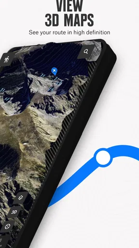
That focus is also why I would not judge it only by whether it gets me from one trailhead to another. The stronger question is whether the map helps me make a better choice before I commit: which route looks manageable, where I might pause, and whether the landscape around a trail changes what I should expect. The 3D view can make the terrain easier to picture than a flat route line, although it remains a planning aid, not a guarantee about conditions on the ground.
Getting Started with onX Backcountry
First things first, downloading onX Backcountry Trail Maps GPS is a breeze. Available for both Android and iOS, the app is light on storage but heavy on features. Upon opening it for the first time, I was greeted with a clean, user-friendly interface that made me feel right at home.
The app asks for a few permissions, such as location access, which is pretty standard for a GPS-based tool. Once that's set up, you're good to go. The main dashboard showcases a variety of features, but the real star here is the map itself. It's detailed, intuitive, and packed with information.
Exploring the Maps
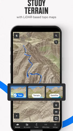
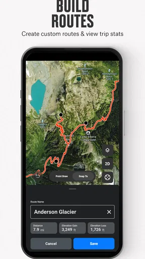
Now, let's talk maps. The mapping feature is where this app truly shines. It offers topographic maps, satellite imagery, and even hybrid views, so you can choose the best option for your adventure. The level of detail is impressive, showing everything from elevation contours to trailheads and waypoints.
Worth Reading Before You Choose

EA SPORTS FC Mobile 26 Is a Bigger Football Game, but It Takes Time

Flipboard Shows What News Apps Must Do Beyond the Feed

Switching to Android Auto Means Rethinking Your Driving Routine

Google Calendar Makes a Crowded Week Easier to Manage

Ludo King Makes the Most of the Minutes Between Plans

Baby Panda World Brings Quick Play to Modern Phones, but Its Game Library Feels Busy
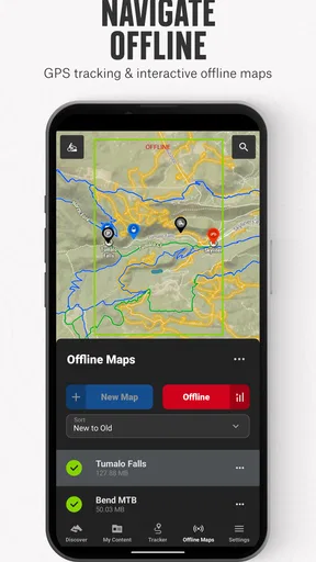
I took the app for a spin during a weekend hike, and it really proved its worth. The offline maps feature was a lifesaver, allowing me to download maps ahead of time and access them without cell service. This is perfect for those remote trails where signal is a distant memory.
A practical offline workflow
Offline access is most helpful when I treat it as a preparation step, not something to sort out at the parking area. Before leaving home, I can identify the area I expect to cover, download the relevant map while connected, and then check that I can still view it before setting off. That small check avoids discovering at a trail junction that the map I needed was never saved for offline use.
I would also keep the planned area realistic. Downloading only the map around a single trail can leave little room for a last-minute change, while trying to prepare an enormous region may be unnecessary for a short outing. A sensible buffer around the intended route gives me options if I turn back, take a side path, or need to orient myself from a different point. Offline maps help with access to map information; they do not make a phone’s battery last forever or replace a paper backup and sound judgment on a remote trip.
For a familiar local walk, a regular phone map may be enough. The extra value here becomes clearer when the route enters terrain where cell coverage is uncertain or the map needs to communicate more than street directions. If I were heading out with a group, I would still agree on the route and meeting point before losing service rather than assuming every person can depend on one phone.
Tracking Your Journey
One feature I found particularly useful was the tracking capability. It logs your path, distance, elevation gain, and even your speed. At first, I thought this might just be a gimmick, but it turned out to be a fantastic way to keep track of my progress and reflect on the hike later. Plus, it’s a great way to challenge yourself to do better next time!
The app also allows you to set waypoints. This was especially handy for marking spots I wanted to return to, like a scenic viewpoint or a perfect picnic spot. It’s these little touches that make onX Backcountry so user-friendly.
Making a track useful after the outing
A saved track is more useful to me as a memory and planning reference than as a scorecard. Reviewing the path can help me remember where I took a wrong turn, where the climb felt harder than expected, or where a rest stop made the day more comfortable. If I repeat the outing later, that context can be more useful than simply comparing a single number from one hike to another.
Waypoints work best when I give them a clear purpose. A marker for a trail junction or a viewpoint is easy to understand later; a collection of unnamed pins can become clutter. I would mark only locations I have a reason to revisit or explain to someone else. That keeps the map readable and makes shared information more useful rather than turning it into a scrapbook of arbitrary points.
For a realistic weekend plan, I might check a route at home, save a nearby viewpoint as a waypoint, and use the track afterward to recall how the outing went. That is a modest workflow, but it connects planning, navigation, and reflection without requiring me to treat every hike like a training session. People who mainly want detailed exercise coaching may prefer a dedicated fitness tracker; this app’s appeal is the relationship between the track and the terrain around it.
Community and Sharing
Another cool aspect is the community feature. You can share your tracks with friends and family, which adds a social element to your adventures. It’s always fun to see where others are hiking and discover new trails through their experiences.
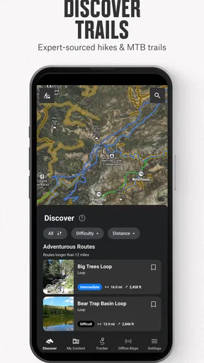
Moreover, the app includes trip reports and trail reviews from other hikers. It’s like having a built-in guidebook, full of tips and insights that can really enhance your trip planning. I found myself spending quite a bit of time browsing these when planning my hikes.
Using other people’s experience wisely
Trip reports are best treated as clues, not promises. A report can help me notice a route or learn what another hiker found memorable, but it describes that person’s outing rather than guaranteeing the same experience for me. I would compare what I read with the map, my own ability, and the conditions I expect on the day. A trail that suited someone else may not suit my group, schedule, or equipment.
Sharing a track can also be useful for coordination: someone at home can understand the general route I planned, or a friend can follow the same line when arranging a later outing. I would avoid treating a shared track as a substitute for a clear plan, especially when the group is splitting up or heading somewhere remote. The map is a practical way to communicate where a trip went, but the people using it still need to agree on what the information means.
Additional Features
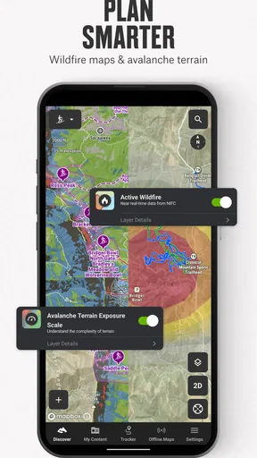
If you’re into backcountry skiing, you’re in luck. The app includes snow mode, which provides information on slope angles and avalanche forecasts. While I haven’t tried this feature myself, my skiing friends swear by it.
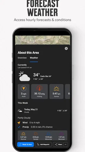
There’s also a weather overlay, giving you real-time updates on weather conditions. I found this particularly useful for planning my hikes and avoiding any unexpected bad weather.
Choosing the right tool for the outing
Compared with a basic navigation app, onX Backcountry puts more emphasis on outdoor terrain and trip context than on getting around streets. Compared with a dedicated fitness app, it gives more attention to maps, routes, and places than to workouts and performance trends. That makes the choice fairly simple: if I want a specialized backcountry map for hiking, biking, or skiing, this is a more relevant fit than a general-purpose map; if I only need directions on a familiar urban path, it may be more tool than I need.
The ski information deserves particular care. Slope angles and avalanche forecasts can support planning, but they should not be mistaken for a full safety assessment or a substitute for training and current local decision-making. I would use the map as one input, check conditions through appropriate sources, and change plans when the terrain or forecast makes the outing unsuitable. The same principle applies to weather overlays: useful for awareness, not a reason to ignore changing conditions.
There is also a cost decision to make. The app is free to install, while in-app purchases range from $14.99 to $99.99 per item. I would explore the free experience first and decide whether the features I actually need justify paying for more access, rather than assuming every outdoor user needs the same level of access. That is especially sensible if I hike only occasionally or already rely on another map source.
Who gets the most from it
I think the best match is someone who regularly plans outdoor routes and wants one place to inspect terrain, save a map for an area with unreliable service, record a trip, and keep useful markers. Hikers who revisit local trails can use tracks and waypoints to make repeat outings easier to plan. Mountain bikers and backcountry skiers may value the outdoor-specific focus, though the usefulness of any one feature depends on the kind of terrain and trip they choose.
I would skip it if my needs are limited to city navigation, casual walks on clearly signed paths, or detailed workout analytics. It may also be a poor fit for anyone who expects an app to make remote travel safe by itself. A phone map is only one part of preparation: I still need enough battery, a realistic route, appropriate equipment, and the willingness to turn around when circumstances change. If I already have a mapping tool that covers the terrain I visit and works the way I need, switching just for the sake of having another app may add complexity without much benefit.
Final Thoughts
All in all, onX Backcountry Trail Maps GPS is more than just a mapping app; it's a comprehensive tool for any outdoor enthusiast. Whether you're a hiker, biker, or skier, there's something here for everyone. It's intuitive, packed with features, and designed with the user in mind.
While there’s a subscription fee for full access, the wealth of features you gain makes it a worthwhile investment for anyone serious about their outdoor adventures. So, if you're looking to elevate your trail experience, give onX Backcountry a try. Trust me, you won’t regret it!
My recommendation before heading out
My practical recommendation is to try the map on a short, familiar outing before depending on it for a more demanding trip. Explore the map at home, decide what you want to save, and see whether the controls and information suit the way you plan. That lets you learn the app without the pressure of making a navigation decision in unfamiliar terrain.
The main trade-off is that a rich mapping tool asks for a little more preparation than simply opening a map when you arrive. For people who enjoy comparing routes and understanding the landscape, that preparation is part of the appeal. For someone who wants the simplest possible directions and rarely leaves reliable coverage, it may feel unnecessary. My overall view is that the app earns its place when terrain-aware planning and offline map access are regular needs, not merely occasional curiosities.
Pros
- Comprehensive trail maps coverage.
- Offline access for remote areas.
- Real-time GPS tracking feature.
- Detailed terrain and elevation data.
- User-friendly interface design.
Cons
- Limited free features available.
- High battery consumption.
- Occasional GPS inaccuracies.
- Requires account sign-up.
- Paid subscription can be pricey.
FAQs for onX Backcountry Trail Maps GPS
What is onX Backcountry Trail Maps GPS used for?
onX Backcountry Trail Maps GPS is designed for outdoor enthusiasts who enjoy hiking, skiing, and exploring backcountry trails. The app provides detailed trail maps, GPS navigation, and real-time weather updates, making it an essential companion for planning and safely navigating outdoor adventures.
How does the GPS feature work without a mobile signal?
onX Backcountry offers offline maps, allowing you to download specific trail maps in advance. Once downloaded, the GPS functionality continues to operate without a cell signal, using your device’s GPS capabilities to provide accurate positioning and navigation while off the grid.
Can I track my progress and share my routes with friends?
Yes, onX Backcountry includes a tracking feature that records your route, distance, speed, and elevation gain. You can save your completed routes and share them with friends directly from the app, making it easy to compare experiences and plan future trips together.
Is there a subscription fee for using onX Backcountry?
The app offers a free version with basic features, but for full access, including advanced mapping tools and offline maps, a subscription is required. Various plans are available to suit different needs, and users can choose between monthly or annual subscriptions.
How reliable is the weather information provided by the app?
onX Backcountry integrates real-time weather updates and forecasts, which are sourced from reliable meteorological data providers. The app delivers current weather conditions and alerts for your location, helping you make informed decisions while planning and during your adventures.


